


Le Sel de Bretagne

nolsim
User

Length
42 km

Max alt
110 m

Uphill gradient
391 m
Km-Effort
47 km

Min alt
18 m

Downhill gradient
427 m
Boucle
No
Creation date :
2019-09-12 12:24:34.251
Updated on :
2019-09-12 16:17:41.798
3h52
Difficulty : Very easy

FREE GPS app for hiking
 SityTrail
IGN / Geographical institutes
SityTrail Plus
The world is yours!
About
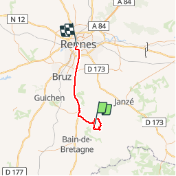
Trail Walking of 42 km to be discovered at Brittany, Ille-et-Vilaine, Le Sel-de-Bretagne. This trail is proposed by nolsim.
Description
beaux chemins
Positioning
Country:
France
Region :
Brittany
Department/Province :
Ille-et-Vilaine
Municipality :
Le Sel-de-Bretagne
Location:
Unknown
Start:(Dec)
Start:(UTM)
603653 ; 5305662 (30T) N.
Comments